Topographic Maps – An Introduction
When we think of maps, we often envision simple tools for navigation. Yet, maps come in many forms, each with unique purposes and methods of presentation. One standout category is topographic maps, which provide a detailed visual representation of the Earth’s terrain. These maps are vital for adventurers, scientists, urban planners, and military strategists alike, offering insights into the physical contours and features of the land.
This introduction explores topographic maps within the larger framework of physical map types, alongside political maps and thematic maps, as discussed in the “Types of Physical Maps” article. We’ll cover their history, key features, applications, and how they fit into the broader world of cartography.
What Are Physical Maps?
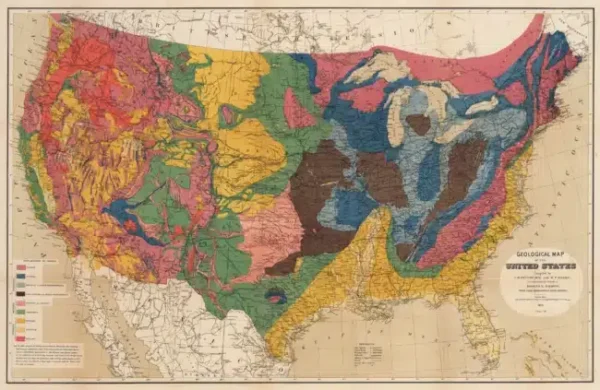
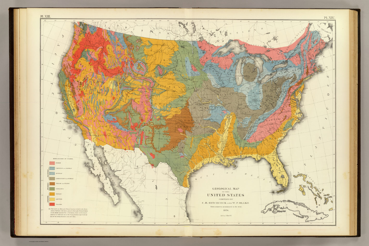
Physical maps are designed to depict the natural features of the Earth’s surface, offering a visual overview of geography. They come in several forms, such as:
- Topographic Maps: Focus on elevation, relief, and terrain.
- Political Maps: Highlight man-made boundaries like countries, states, and cities.
- Thematic Maps: Use data to tell a story, such as population density, climate patterns, or resource distribution.
Unlike political maps that emphasize human divisions or thematic maps that visualize data trends, topographic maps stand out for their ability to represent the three-dimensional surface of the Earth on a two-dimensional medium.
A Unique Window to the Landscape
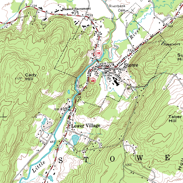
Topographic maps combine precision and artistry, providing intricate details about the Earth’s surface. Using contour lines, colors, and symbols, these maps reveal elevation changes, natural landmarks, and human structures in a way that is both functional and visually compelling.
Key Features of Topographic Maps
- Contour Lines
- These lines connect points of equal elevation, creating a visual guide to the shape of the terrain.
- Closely spaced lines indicate steep slopes, while widely spaced lines represent gentler gradients.
- Relief Representation
Relief is the variation in elevation across the terrain. By using shading, hachures, and contour lines, cartographers provide a three-dimensional perspective. - Color and Symbols
- Colors: Brown for elevation, green for vegetation, blue for water bodies.
- Symbols: Represent human-made features like roads, bridges, and boundaries, as well as natural features like forests and cliffs.
- Scale and Projection
Topographic maps use precise scales to maintain accuracy. Common scales include 1:24,000, suitable for hikers and detailed navigation, and 1:250,000, ideal for broader regional planning.

Fun Fact: The difference in elevation between two contour lines is called the contour interval, which varies depending on the map's scale and purpose.
Historical Context of Topographic Mapping
The evolution of topographic maps is a testament to human ingenuity. Long before satellites and GIS, early cartographers relied on tools like compasses, sextants, and manual surveys.
- 18th Century: The Cassini family in France developed one of the first comprehensive topographic mapping systems, leading to the Carte de France.

- 19th Century: National surveys like the United States Geological Survey (USGS) began producing topographic maps for public and military use.
- Modern Day: Advances in remote sensing and satellite imaging have made topographic mapping more accessible and accurate than ever before.
A Comparison with Other Map Types
Understanding topographic maps is easier when comparing them to other forms of physical maps, such as political and thematic maps:
Political Maps
- Focus: Highlighting man-made boundaries, such as countries, states, and cities.
- Purpose: Useful for understanding geopolitical divisions but lack details about the physical terrain.
- Example: A political map might show state borders, but it won’t reveal the mountain ranges or rivers that define those borders.
Thematic Maps
- Focus: Presenting specific data, like climate zones, population density, or migration patterns.
- Purpose: They tell a story through visual data, making them ideal for specialized studies.
- Example: A thematic map of rainfall might overlap geographic features but won’t provide precise elevation details.
Topographic maps, however, bridge the gap between these two, offering a scientific yet artistic representation of the Earth’s surface that supports practical navigation and exploration.
Applications of Topographic Maps
Topographic maps are invaluable in various fields, serving purposes as diverse as their users:
- Hiking and Outdoor Recreation
- Hikers use these maps to identify trails, navigate challenging terrains, and avoid obstacles like cliffs or water crossings.
- Example: Planning a trek through the Grand Canyon is impossible without a reliable topographic map to highlight elevation changes and trail difficulty.
- Geology and Environmental Science
- Geologists analyze landforms, study fault lines, and predict geological activity using topographic maps.
- Environmentalists use them to map watersheds and monitor ecosystems.
- Urban Planning and Development
- Urban planners rely on topographic maps to assess land suitability for construction, identify flood-prone areas, and design infrastructure.
- Case Study: The expansion of New York City’s subway system depended on accurate topographic data to plan tunnels and routes.
- Military Operations
- In warfare, understanding terrain is critical. Topographic maps help strategists determine troop movements and fortification placements.
- Education and Research
- Topographic maps are essential tools in classrooms, teaching students about geography, landforms, and map reading skills.
How to Read a Topographic Map
Reading a topographic map may seem daunting at first, but with practice, it becomes second nature.
- Start with the Legend
Learn the meaning of the map’s symbols, colors, and contour intervals. - Examine Contour Lines
- Determine elevation changes.
- Note patterns, such as concentric circles indicating hills or depressions.
- Check the Scale and Orientation
Understand distances and align the map to your surroundings using a compass. - Plan Your Route
Identify paths that minimize steep climbs or highlight interesting features.
The Importance of Topographic Maps in Modern Cartography
Despite advancements in digital mapping, topographic maps remain irreplaceable. Their level of detail is unmatched, and they serve as the foundation for many digital mapping applications, including GPS and GIS systems.
Did You Know?
- Google Maps and other digital tools often use topographic data to calculate elevation changes for walking or biking routes.
- Topographic data is also critical for disaster response, helping agencies assess landslide risks, plan evacuations, and rebuild infrastructure after natural disasters.
The Role of Topographic Maps in the Bigger Picture
In the broader context of physical maps, topographic maps complement political and thematic maps by focusing on the Earth’s natural features. While a political map might show the boundaries of the Himalayan region, and a thematic map could highlight population density there, only a topographic map would reveal the staggering elevation changes and intricate details of the mountain range.
This synergy between map types enhances our ability to understand, interpret, and interact with the world.

The Influence of Art Movements on Map Design