An Essential Guide to Understanding Boundaries and Relationships
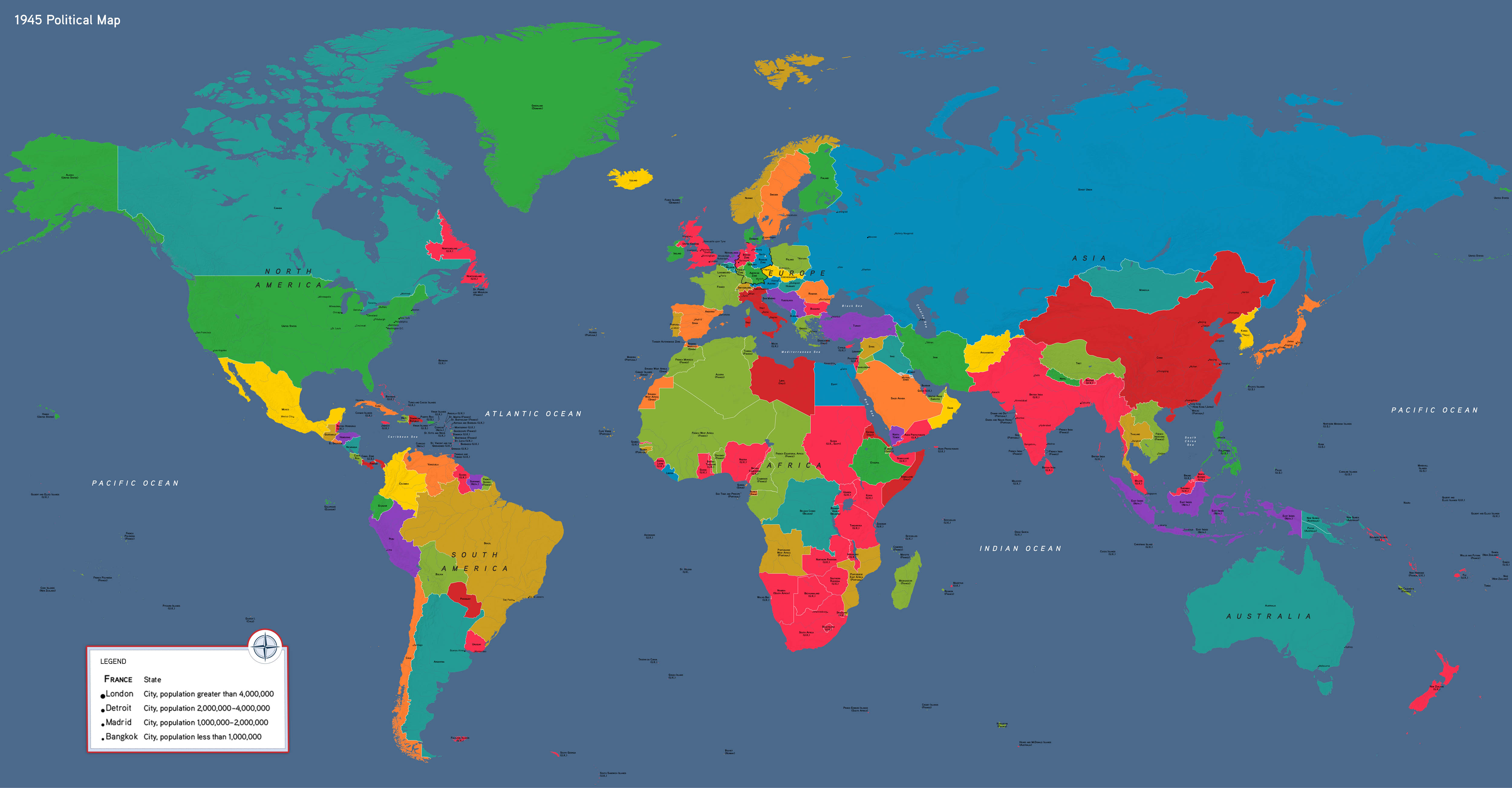
Political maps are one of the most widely recognized and utilized types of physical maps. They depict the world not as it exists in terms of terrain or natural features, but through the lens of human-defined boundaries and governance.
By showcasing countries, states, cities, and other political divisions, these maps serve as indispensable tools for education, governance, travel, and diplomacy.
This guide delves deep into the purpose, features, history, and applications of political maps, while connecting them to their counterparts such as topographic and thematic maps, as discussed in Types of Physical Maps.
What Are Political Maps?
Political maps are designed to display political boundaries rather than the natural layout of the Earth.
Unlike topographic maps, which focus on physical terrain, or thematic maps, which illustrate data trends, political maps center on human-made divisions like countries, states, provinces, and cities.
Key Features of Political Maps
- Boundaries and Borders: These maps clearly delineate international, national, and regional borders using bold lines or color variations.
- Political Units: They label sovereign nations, states, provinces, and sometimes municipalities.
- Capital Cities and Major Urban Centers: Most political maps highlight capitals with unique symbols and identify other major cities for reference.
- Color Coding: To make distinctions clear, different regions are color-coded, often in contrasting hues.
- Geographical Context: While the focus is political, some political maps also include natural features like rivers and mountain ranges to provide context.
Political maps are foundational tools for understanding human governance and spatial organization.
Whether displayed on a classroom wall or used in a diplomatic meeting, they provide an immediate visual representation of the global or regional political landscape.
History of Political Maps
The history of political maps is deeply intertwined with the history of civilization and governance.
As humans transitioned from nomadic societies to settled communities, the need to define territories and boundaries became crucial.
Early Political Maps
- The first known political maps date back to ancient Mesopotamia (c. 2300 BCE), where clay tablets marked territories and land ownership.
- The Greeks and Romans further developed political cartography, creating maps to delineate the extent of their empires.
The Middle Ages and Renaissance
- During the Middle Ages, political maps were heavily influenced by religious ideologies. Maps like the T and O maps depicted the known world divided into three continents: Europe, Asia, and Africa.
- The Renaissance saw a shift toward more accurate representations of political boundaries, spurred by exploration and colonial expansion.
Modern Political Maps
- With the advent of the nation-state system in the 17th century, political maps became more detailed and standardized.
- The 20th century, marked by two world wars and the decolonization of Africa and Asia, brought dramatic changes to international borders, making political maps essential for understanding global changes.
Applications of Political Maps
Political maps are not just tools for geography; they play a critical role in numerous fields, from education to international relations.
1. Education
Political maps are fundamental tools in schools and universities. They help students understand the political layout of the world, identify countries and capitals, and analyze how borders have evolved over time.
2. Governance and Diplomacy
For policymakers and diplomats, political maps are indispensable in negotiations, treaties, and conflict resolution. They are used to discuss territorial disputes, trade routes, and political alliances.
3. Travel and Tourism
Travelers rely on political maps to plan routes, understand visa requirements, and navigate unfamiliar regions. Political maps are often included in guidebooks and atlases to provide quick references.
4. Economic and Business Applications
Businesses use political maps to identify markets, analyze trade routes, and understand regional regulations. For instance, global corporations may use maps to plan distribution networks across multiple countries.
5. Military and Strategic Planning
Military organizations depend on political maps for operational planning, particularly when dealing with cross-border operations or territorial disputes.
Comparing Political Maps to Other Physical Maps
While political maps focus on human-defined boundaries, they often overlap with other types of physical maps like topographic and thematic maps, creating a more comprehensive understanding of the world.
Political Maps vs. Topographic Maps
- Political Maps: Highlight borders and human governance structures.
- Topographic Maps: Focus on terrain, elevation, and natural features.
Despite their differences, political maps sometimes incorporate physical features like rivers and mountains to provide context, especially when these features act as natural boundaries.
Political Maps vs. Thematic Maps
- Political Maps: Serve as a baseline for understanding political divisions.
- Thematic Maps: Focus on specific data trends, such as population density or election results.
Thematic maps often use political maps as their foundation, overlaying data like economic zones, climate patterns, or migration trends.
Modern Innovations in Political Maps
With advances in technology, political maps have evolved far beyond static representations on paper.
1. Interactive Political Maps
Digital tools like Google Maps and GIS platforms allow users to explore political boundaries interactively. These tools often combine political maps with other types, such as topographic or thematic layers.
2. Real-Time Updates
In the past, political maps were static, often becoming outdated as borders shifted. Today, platforms like GPS and online mapping services update borders in real-time to reflect political changes.
3. Specialized Political Maps
Modern political maps cater to specific needs, such as electoral district maps, trade zone maps, and regional planning maps.
Why Are Political Maps Important?
Political maps remain one of the most relevant and versatile tools in cartography for several reasons:
1. Clarity of Governance
They provide a visual understanding of how the world is organized politically, from countries to municipalities.
2. Facilitating Global Connections
Political maps are vital in understanding international relationships, trade, and cultural exchange.
3. Conflict Resolution
By clearly marking borders and disputed territories, political maps help in resolving conflicts diplomatically.
4. Historical Insight
Comparing historical and modern political maps offers insights into how borders and governance have evolved over time.
The Future of Political Maps
As the world becomes increasingly interconnected, political maps will continue to evolve. Potential developments include:
- Augmented Reality Maps: Allowing users to visualize political boundaries in 3D.
- Dynamic Maps: Showing historical changes to borders, helping users understand the fluidity of political landscapes.
- Data Integration: Combining political maps with real-time data on trade, migration, and natural resources for a holistic view.
Guide to Understanding Boundaries and Relationships
