Advanced Technology in Modern Mapmaking

Modern mapmaking, a cornerstone of navigation, urban planning, and scientific research, has evolved into a sophisticated field thanks to technological innovations.
Below is an authoritative yet approachable exploration of the cutting-edge technologies driving the industry, designed to inspire enthusiasts and professionals alike.
Digital Mapping and Big Data Integration
Digital tools have revolutionized how we create and interpret maps. Platforms like Google Maps and OpenStreetMap leverage big data and user-generated content to create real-time, detailed maps.
These tools rely on data collected from satellites, drones, and IoT devices to provide highly precise geospatial information, essential for navigation, logistics, and even weather prediction.
For example, Google’s Live View uses AI to integrate real-time data with augmented reality, guiding users in complex urban settings like New York City or Tokyo.
Why it matters: These systems not only make navigation more accessible but also adapt to unique user needs, such as highlighting points of interest or providing congestion updates. This integration makes modern maps both dynamic and user-centric.
Autonomous and Indoor Mapping Technologies
Autonomous systems like self-driving cars depend on high-definition (HD) mapping to navigate safely.
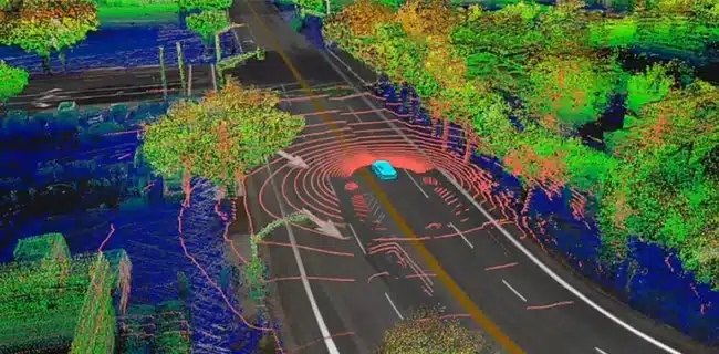
These maps are layered with extensive data, including road elevations, traffic patterns, and even weather conditions.
Similarly, indoor mapping has emerged to address GPS limitations in enclosed spaces.
Technologies like Bluetooth beacons and visible light communications enable detailed navigation in malls, airports, and museums.
Example in action:
The DiveNET GPS system uses underwater sonar with proprietary signal modeling and processing techniques which they claim to provide reliable, long-range performance even in harsh hydroacoustic conditions meaning that modern mapping extends even to the ocean floor.
3D and 4D Mapping
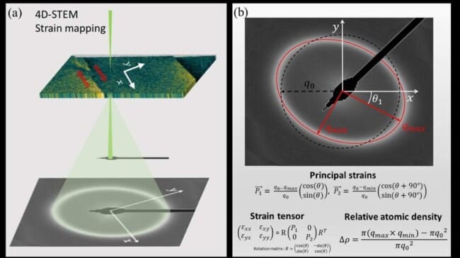
Traditional 2D maps have transformed into immersive 3D models of environments, offering depth and context for various industries.
The advent of 4D mapping adds a temporal layer, allowing users to track changes over time.
For instance, urban planners can visualize city growth, and environmentalists can monitor innovation:
These maps enable context-aware navigation, showing information relevant to specific scenarios—like walking paths or open restaurants—based on time and user intent.
Modern mapmaking is undergoing a revolution with the integration of machine learning into 4D mapping—mapping that combines 3D spatial dimensions with time.
These advanced techniques enhance data processing, enabling rapid interpretation and the detection of subtle patterns in vast datasets.
They also allow for dynamic, real-time visualizations and improved accuracy by refining algorithms as more data becomes available.
Unlike traditional methods, machine learning-driven 4D mapping is scalable, adaptable, and continuously improving, making it a powerful tool for uncovering complex spatial-temporal insights, including the secrets of the oceans.
AI and Machine Learning in Cartography
Artificial intelligence plays a significant role in automating map creation. AI analyzes vast datasets to detect patterns, such as road layouts or population density.
Machine learning is used more and more to correct errors in dense urban environments where GPS signals are often unreliable, ensuring users know precisely where they are.
Did You Know?
AI also helps create thematic maps, overlaying layers like weather patterns or geological data for specialized applications.
Machine learning doesn’t just assist professionals—it’s embedded in tools you use daily, like Google Maps, enhancing real-time traffic updates and navigation suggestions.
Remote Sensing and Satellite Technology
Remote sensing technology, including satellites and drones, provides detailed imaging for mapmaking.
High-resolution images allow cartographers to update maps with features like new roads, land use changes, or environmental shifts.
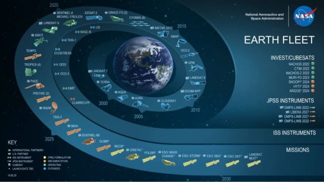
Satellites such as those used by NASA or private firms like Maxar Technologies capture real-time data critical for disaster response and climate monitoring.
Impact example: During natural disasters, up-to-date satellite maps enable first responders to assess damage and plan rescue operations effectively.
Open Data and Collaborative Mapping
Collaborative mapping has revolutionized cartography by inviting public contributions. Platforms like OpenStreetMap rely on community input to update and expand maps, offering detailed and accurate data.
This open-data approach enables communities to map underrepresented areas, quickly adapt to changes, and contribute to global geospatial knowledge.
Organizations and developers harness these open-source frameworks to create new mapping applications, pushing innovation across sectors.
Shared resources and global collaboration have made mapping more inclusive and adaptive to users’ needs.
Fun fact: More than 20% of online searches involve geospatial data. Open platforms make these searches more reliable and contribute to the widespread adoption of location-based services.
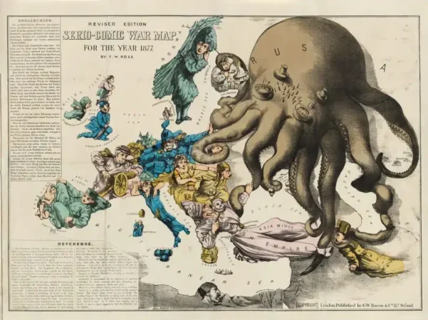
The Influence of Art Movements on Map Design