Types of Physical Maps

There are three main types of physical maps, each serving a distinct purpose. Let’s break them down:
1. Topographic Maps
- Focus: Detailed representation of elevation and terrain.
- Features:
- Contour lines to show elevation changes.
- Color-coding to indicate terrain types (e.g., green for forests, brown for higher elevations, blue for water bodies).
- Symbols for landmarks and man-made features like buildings and trails.
- Applications:
- Navigation for hikers, explorers, and adventurers.
- Scientific studies of landforms and geological processes.
- Urban planning and infrastructure development.
Topographic maps are considered the most detailed physical maps, combining precise measurements with visual clarity. For more on topographic maps, see Topographic Maps – An Introduction.
2. Political-Physical Hybrid Maps
- Focus: Combine natural features with political boundaries.
- Features:
- Highlight rivers, mountains, and forests while overlaying countries, states, or city borders.
- Labels for major cities, capitals, and points of interest.
- Applications:
- Educational tools for students learning both geography and geopolitics.
- Travel planning, as these maps provide a quick reference for understanding natural features alongside administrative divisions.
Political-physical maps serve as a great starting point for casual map users seeking a mix of natural and political data.
3. Thematic Physical Maps
- Focus: Visualizing data trends tied to physical geography.
- Features:
- Maps showing climate zones, rainfall distribution, vegetation patterns, or earthquake activity.
- Use of shading, graphs, or overlays to present specific data sets.
- Applications:
- Research into environmental changes, such as global warming or deforestation.
- Planning for agriculture, tourism, or disaster management.
Thematic physical maps provide insights into how natural features interact with human activity or climate, making them a popular choice for scientists and policymakers.
Why Are Physical Maps Important?
Physical maps play a crucial role in helping us understand the natural world and its relationship to human life. Some of the key benefits include:
- Navigation and Exploration
- Physical maps, particularly topographic maps, are indispensable for adventurers, hikers, and sailors who need precise details about terrain, elevation, and landmarks.
- Scientific Research
- Geologists, environmentalists, and biologists rely on physical maps to study ecosystems, geological formations, and weather patterns.
- Urban and Infrastructure Planning
- Engineers and planners use these maps to assess the suitability of land for construction, water management, or agriculture.
- Education
- Physical maps are essential tools for teaching geography, geology, and environmental science in classrooms worldwide.
- Preservation of History
- Many physical maps, especially historical ones, serve as a record of how the Earth and its features have changed over time.

Credit manuscriptmaps
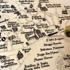
Maps are not just tools for navigation—they are masterpieces of precision and creativity, blending science, art, and history. Let’s delve into the artistic and technical genius behind the making of physical maps, celebrating the craftsmanship that has shaped our understanding of the world.
“A map of the world that does not include Utopia is not worth even glancing at, for it leaves out the one country at which Humanity is always landing. And when Humanity lands there, it looks out, and, seeing a better country, sets sail. Progress is the realisation of Utopias.” ― Oscar Wilde, The Soul of Man Under Socialism
Topographic Maps
Middle English topographie, from Late Latin topographia, from Greek, from topographein to describe a place, from topos place + graphein to write (Merriam-Webster)
Maps have been an integral part of human history, serving as a tool for navigation, exploration, and discovery. From ancient civilizations to modern-day adventurers, maps have played a crucial role in shaping our understanding of the world. In this article, we will delve into the different types of physical maps, exploring their unique characteristics, uses, and significance.
Topographic map features:
- Contour lines to represent elevation and relief
- Scale and legend to provide context and accuracy
- Symbols and markings to identify natural and man-made features
- Grid system to facilitate navigation and measurement

Credit genedailey/Fotolia
The Role of Topographic Maps Within Physical Maps
While all physical maps focus on Earth’s features, topographic maps stand apart for their precision and versatility. Unlike other physical maps that may provide broad overviews, topographic maps excel at capturing minute details, making them invaluable for:
- Navigating Complex Terrains: Hikers, climbers, and even military personnel depend on topographic maps for their clarity in elevation changes.
- Analyzing Geological Features: Geologists can identify fault lines, volcanic activity, and erosion patterns.
- Understanding Human Impact: Urban planners can evaluate areas at risk of flooding or soil erosion, ensuring safer developments.
Comparison to Other Physical Maps
- Political Maps focus on boundaries and offer little detail about terrain.
- Thematic Maps visualize specific data but lack the intricate terrain details that topographic maps provide.
How Are Physical Maps Made?
The creation of physical maps has evolved dramatically over the centuries, blending art and science.
Historical Techniques
- Early maps were hand-drawn based on explorers’ observations.
- Relief maps, like those from the Renaissance, depicted elevation with artistic shading.
Modern Methods
- Remote Sensing: Satellites capture high-resolution images of the Earth’s surface.
- Geographic Information Systems (GIS): Computer systems process and analyze geographic data to create detailed, scalable maps.
- Digital Elevation Models (DEMs): 3D models generated from satellite data provide precise elevation data.
These advancements have not only improved map accuracy but also made physical maps accessible to a broader audience.
Political maps, on the other hand, focus on the boundaries and divisions between countries, states, and other administrative regions.
These maps are used to identify territorial claims, international borders, and areas of conflict. Political maps are essential for diplomats, policymakers, and researchers, as they provide a visual representation of the complex web of global relationships.

What Do Political Maps Show?
At their core, political maps depict the borders of countries, states, provinces, and cities, providing a clear picture of how the world is divided and organized. These maps use distinct features to communicate their information effectively:
- Boundaries and Borders: Bold lines or color variations clearly differentiate political entities. For example, countries are often shaded in contrasting colors to make them easily distinguishable.
- Labels and Place Names: Political maps prominently label nations, capitals, cities, and sometimes smaller administrative regions.
- Capital and Major Cities: Capitals are often marked with unique symbols (like a star) to highlight their importance, alongside other significant urban centers.
- Geographical Context: While the focus is political, some maps include natural features like rivers and mountains to provide context, especially when these act as natural boundaries.
Political maps offer an instant snapshot of geopolitical relationships, making them a powerful tool for understanding the world at a glance.
Uses of Political Maps
- Education
Political maps are staples in geography and history classrooms, helping students learn the layout of countries, capitals, and regions. They are often a starting point for understanding global politics and cultural diversity.
- Travel and Tourism
Travelers use political maps to navigate international and regional boundaries, understand visa requirements, and plan their journeys. Political maps often accompany guidebooks to offer quick geographical insights.
- Government and Diplomacy
Political maps are used in diplomatic discussions, treaties, and negotiations. They are particularly vital when addressing border disputes or international relations.
- Historical and Geopolitical Analysis
Comparing modern and historical political maps helps researchers and historians analyze how boundaries have evolved due to wars, treaties, colonization, and independence movements.
You might want to consider visiting the political maps category for more in-depth information.

Thematic Maps

Thematic maps are a type of map that provides a visual display of geospatial information based on a specific theme or topic. These maps pull together relevant data of a subject, such as Covid cases, election results, or income distribution, and represent this information spatially, or in regard to geographic locations.

Such maps can be used to answer specific questions, such as “Which coastal areas are most at risk for flooding?” or “What transportation infrastructure should be prioritized to help commuters?“. They can also be used to display information on a particular topic or theme, such as sea level trends, commuting behaviors, or the distribution of rainfall in an area.

They can be created using various techniques, including choropleth maps, heat maps, charts, and symbols. They can also be used to display comparative information, such as the distribution of a particular variable across different geographic locations.

Thematic maps are designed to illustrate the relationship between a theme and physical space, such as trade patterns, the spread of disease, or demographic trends. They are used to analyze the spatial distribution of information, identify patterns and trends, and gain insights into a particular subject.
Practical Tips
- When reading a topographic map, pay attention to contour lines and elevation markers to understand the terrain.
- Use a political map to identify international borders and territorial claims.
- Study a physical map to understand the relationships between natural systems and the environment.
How to Use Physical Maps Effectively
Using physical maps requires an understanding of their scale, symbols, and features. Here are some quick tips:
- Understand the Scale
- A small-scale map covers a large area with less detail (e.g., 1:500,000).
- A large-scale map provides more detail but covers a smaller area (e.g., 1:24,000).
- Decode the Legend
- Physical maps rely on standardized symbols and color codes. Refer to the legend for quick interpretation.
- Pair with Digital Tools
- Use physical maps alongside GPS or GIS for better accuracy and real-time updates.
The Future of Physical Maps
Despite the rise of digital navigation tools, physical maps remain essential. Their tactile, visual nature allows for a deeper understanding of the land, free from the limitations of technology like battery life or signal range.
Future trends include:
- Augmented Reality (AR): Combining physical maps with AR apps to enhance visualization.
- Interactive Educational Tools: Physical maps integrated with digital overlays for schools and museums.